


PLEASANT TWP Voting District, Brown County, Ohio
About
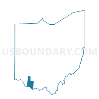
Outline

Summary
| Unique Area Identifier | 642952 |
| Name | PLEASANT TWP Voting District |
| County | Brown County |
| State | Ohio |
| Area (square miles) | 32.38 |
| Land Area (square miles) | 31.92 |
| Water Area (square miles) | 0.46 |
| % of Land Area | 98.58 |
| % of Water Area | 1.42 |
| Latitude of the Internal Point | 38.83697610 |
| Longtitude of the Internal Point | -83.89982670 |
Maps


Graphs
Select a template below for downloading or customizing gragh for PLEASANT TWP Voting District, Brown County, Ohio


Neighbors
Neighoring Voting District (by Name) Neighboring Voting District on the Map
- CLARK HAMERSVILLE Voting District, Brown County, OH
- FRANKLIN TWP Voting District, Brown County, OH
- GEORGETOWN EAST Voting District, Brown County, OH
- GEORGETOWN NORTH Voting District, Brown County, OH
- GEORGETOWN SW Voting District, Brown County, OH
- JEFFERSON RUSS Voting District, Brown County, OH
- LEWIS TWP NORTH Voting District, Brown County, OH
- LEWIS/HIGGINSPORT Voting District, Brown County, OH
- SCOTT TWP Voting District, Brown County, OH
- UNION TWP Voting District, Brown County, OH
Top 10 Neighboring County Subdivision (by Population) Neighboring County Subdivision on the Map
- Pleasant township, Brown County, OH (5,745)
- Clark township, Brown County, OH (3,121)
- Union township, Brown County, OH (3,064)
- Lewis township, Brown County, OH (2,697)
- Augusta CCD, Bracken County, KY (2,623)
- Franklin township, Brown County, OH (1,654)
- Jefferson township, Brown County, OH (1,433)
- Scott township, Brown County, OH (1,294)
Top 10 Neighboring Place (by Population) Neighboring Place on the Map
Top 10 Neighboring Unified School District (by Population) Neighboring Unified School District on the Map
- Western Brown Local School District, OH (17,494)
- Eastern Local School District, OH (8,605)
- Ripley-Union-Lewis-Huntington Local School District, OH (7,150)
- Bracken County School District, KY (7,050)
- Georgetown Exempted Village School District, OH (6,820)
Top 10 Neighboring State Legislative District Lower Chamber (by Population) Neighboring State Legislative District Lower Chamber on the Map
Top 10 Neighboring State Legislative District Upper Chamber (by Population) Neighboring State Legislative District Upper Chamber on the Map
Top 10 Neighboring 111th Congressional District (by Population) Neighboring 111th Congressional District on the Map
Top 10 Neighboring Census Tract (by Population) Neighboring Census Tract on the Map
- Census Tract 9519, Brown County, OH (6,143)
- Census Tract 9515, Brown County, OH (5,423)
- Census Tract 9518, Brown County, OH (5,270)
- Census Tract 9514, Brown County, OH (4,393)
- Census Tract 9517, Brown County, OH (2,673)
- Census Tract 9501, Bracken County, KY (2,623)
Top 10 Neighboring 5-Digit ZIP Code Tabulation Area (by Population) Neighboring 5-Digit ZIP Code Tabulation Area on the Map
- 45121, OH (9,036)
- 45130, OH (3,913)
- 45167, OH (3,764)
- 41002, KY (2,510)
- 45168, OH (1,607)
- 45131, OH (238)